
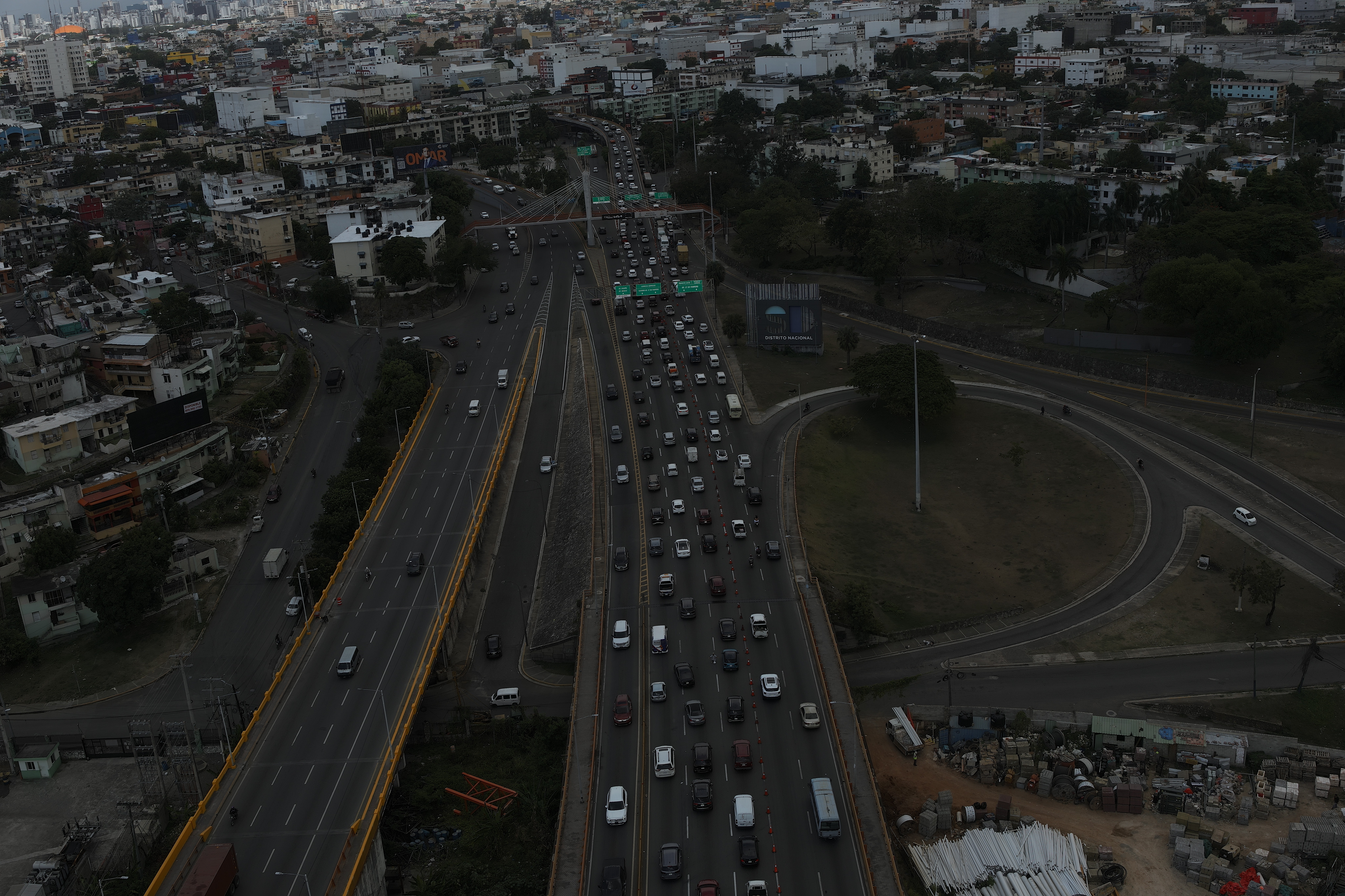
Bridges are among the most critical — and most expensive to repair — structures in any country's infrastructure inventory. In the Dominican Republic, much of the road network crosses rivers, ravines and gullies via bridges that carry heavy traffic, seasonal floods and a tropical climate that accelerates corrosion and concrete deterioration. Catching a problem early is the difference between a minor repair and a road closure. Drone inspection has become the fastest, safest and most detailed way to monitor the condition of these assets. This guide explains how it works, what defects it detects, and why it beats traditional methods.
Why do bridges need periodic inspection?
A bridge starts degrading the day it enters service. The combination of repeated loads, vibration, moisture, salts, concrete carbonation and extreme events — floods, earthquakes, impacts — produces damage that is almost never visible from the roadway. International practice recommends periodic visual inspections, typically every one or two years, plus additional reviews after significant events. The goal is not just to find the damage, but to document how it evolves over time so maintenance can be prioritized before a minor defect becomes a structural failure.
How does a drone bridge inspection work?
A professional drone inspection follows a controlled workflow combining flight planning, high-resolution image capture and technical analysis:
- Planning: the bridge geometry — deck, girders, piers, abutments, bearings, joints — is studied and a flight path is defined to cover every element, including the areas under the deck and over water.
- Capture: the drone flies the structure with a 45 MP camera that records extremely detailed images, able to resolve fractional-millimeter cracks from a safe distance, with no contact with the structure.
- Access to hard-to-reach areas: the drone reaches the underside of the deck, the inner faces of the piers and the bearings — points an inspector can only reach with scaffolding, cranes or rope access.
- Analysis and report: the georeferenced images are reviewed and findings are tagged by type and severity, with their exact location on the element, producing a traceable report the responsible engineer can audit.
A key operational advantage is that the inspection is carried out without closing the bridge to traffic, or with minimal, targeted closures. The drone works from the air while the road keeps operating — impossible with scaffolding or a snooper truck occupying a lane for hours.
What defects does the drone inspection detect?
With high-resolution imagery and rigorous technical analysis, the aerial inspection identifies the main indicators of structural deterioration:
| Element | Defect detected | Why it matters |
|---|---|---|
| Deck and girders | Cracks and fissures | Reveal fatigue, overload or corrosion of the reinforcing steel |
| Concrete | Deterioration, delamination, spalling | Reduces the load-bearing section and exposes the steel |
| Steel and rebar | Corrosion and rust staining | Leading cause of capacity loss in a tropical climate |
| Piers and abutments | Scour at the base | Frequent cause of collapse; worsens with floods |
| Expansion joints | Blockage, breakage, leaks | Cause damage to bearings and girders from pooled water |
| Bearings | Displacement, deterioration, corrosion | Compromise the load transfer from the deck |
By georeferencing each finding on the structure, the inspector can compare successive inspections and measure how much a crack has grown or how far corrosion has advanced between one visit and the next. That continuity is what turns a set of photos into a real asset-management tool.
Advantages over traditional methods
Conventional bridge-inspection methods — erecting scaffolding, snooper trucks (with an articulated arm under the deck) and rope access — still have their place, but they carry important limitations:
- Slower: erecting scaffolding or positioning a snooper truck takes hours or days; a drone covers the same structure in a fraction of the time.
- More costly and intrusive: traditional methods usually require lane closures, signage and heavy equipment that disrupt traffic and road operations.
- Riskier: they put personnel working at height, over water or suspended from ropes; the drone keeps the inspector on the ground, in a safe zone.
- Limited coverage: the underside of the deck and the upper areas of the piers are hard to reach; the drone covers them fully and repeatably.
- Less comparable data: a manual visual inspection is subjective and hard to replicate; georeferenced capture lets you compare the bridge's condition year after year.
Applications in Dominican infrastructure
Drone inspection applies to the entire bridge inventory of the road network: crossings over rivers and creeks, urban viaducts, dam-access bridges and grade-separation structures on highways and expressways. It is especially valuable in the Dominican context, where hurricane-season floods expose piers to scour and tropical humidity accelerates corrosion. A program of periodic aerial inspection lets authorities and concessionaires anticipate maintenance, prioritize repairs by urgency and back investment decisions with objective technical evidence.
On a bridge, the damage you can't see is the one that closes the road. Aerial inspection brings to light what's happening under the deck and at the piers before it becomes an emergency.
At Dronematic we are IDAC-certified operators and have inspected real bridges in the Dominican Republic with 45 MP cameras, capturing the underside of the deck, the piers and the bearings without closing the road to traffic. We deliver reports with findings located and classified by severity, ready for your engineering team to plan maintenance. If you manage bridges or grade-separation structures, we can prepare an inspection proposal for your asset.


